
Småtryk
Småtryk, postkort, plakater og trykte memorabilia.
Søgeresultater
45746 bøger i Småtryk

Right of Way and Track Maps of San Pablo Rancho, Contra Costa County, Ca
Southern Pacific Lines (San Francisco, Calif.) · 1932 · Wittenborn Art Books
$350.00 (€317.55 | £264.92 | ¥55,873)
San Francisco, Calif.: Southern Pacific Company, 1932, rev. 1960. Set of Three Blueline prints, each 24 inches x 56 inches. Includes Sobrante Park, San Pablo Rancho, San Pablo Bay. No buildings detailed. With Schedule of Property listing approx 55 transfers, 1876 - 1960. Scale...

Map of San Francisco Waterfront, San Francisco County, Ca
Southern Pacific Lines (San Francisco, Calif.) · 1932 · Wittenborn Art Books
$375.00 (€340.23 | £283.84 | ¥59,864)
San Francisco, Calif.: Southern Pacific Company, 1932. Blueprint, 23 inches x 55 inches. From Kearny Street to Van Ness Avenue, Fisherman's Wharves to Francisco Streets. Proposed Operation of State Belt Railroad over Souther Pacific Company's Track on Beach Street. With red, y...
Industry Map and Switching Limits Map of San Francisco and Vicinity, San Francisco County, Ca
Southern Pacific Lines (San Francisco, Calif.) · 1949 · Wittenborn Art Books
$750.00 (€680.46 | £567.69 | ¥119,727)
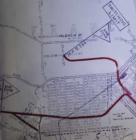
San Francisco, Calif.: Southern Pacific Company, 1949, rev. 1958, switching limit map 1961. Blueline print, 27 inches x 96 inches. From Millbrae to Yerba Buena Island, Hunter's Point to Daly City. With index to industry, approx. 1000 entries, listed both Alphabetically and by ...
Yards Limits Map of San Francisco and Vicinity, San Francisco County, Ca
Southern Pacific Lines (San Francisco, Calif.) · 1918 · Wittenborn Art Books
$450.00 (€408.27 | £340.61 | ¥71,836)
San Francisco, Calif.: Southern Pacific Company, 1918, rev. 1945. Blueline print, 24 inches x 47 inches. From Aqua station beyond South San Francisco to 3rd & Townsend Station, Visitacion to Daly City. Includes track plans for South San Francisco, Visitacion, San Francisco, Ce...
Switching Limits Map of San Francisco and Vicinity, San Francisco County, Ca
Southern Pacific Lines (San Francisco, Calif.) · 1949 · Wittenborn Art Books
$750.00 (€680.46 | £567.69 | ¥119,727)
San Francisco, Calif.: Southern Pacific Company, 1949. Blueline print, 26 inches x 67 inches. From Millbrae to Yerba Buena Island, Hunter's Point to Daly City. With index to industry, approx. 850 entries, listed both Alphabetically and by numerical location on map. Scale appro...

Switching Limits Map of San Francisco and Vicinity, San Francisco County, Ca
Southern Pacific Lines (San Francisco, Calif.) · 1936 · Wittenborn Art Books
$300.00 (€272.18 | £227.08 | ¥47,891)
San Francisco, Calif.: Southern Pacific Company, 1936. Blueline print switching zones map,14 inches x 32 inches, switching zones indicated in red, purple, green, yellow, brown, with red pencil. File cover indicating "Switiching Limits of San Francisco," dated 1962. Three pages...
Industry Map and Switching Limits Map of San Francisco and Vicinity, San Francisco County, Ca
Southern Pacific Lines (San Francisco, Calif.) · 1949 · Wittenborn Art Books
$750.00 (€680.46 | £567.69 | ¥119,727)
San Francisco, Calif.: Southern Pacific Company, 1949, rev. 1958, collected 1962. Blueline print, 27 inches x 96 inches. From Millbrae to Yerba Buena Island, Hunter's Point to Daly City. With index to industry, approx. 1000 entries, listed both Alphabetically and by numerical ...

Industry Map of San Francisco and Vicinity, San Francisco County, Ca
Southern Pacific Lines (San Francisco, Calif.) · 1949 · Wittenborn Art Books
$750.00 (€680.46 | £567.69 | ¥119,727)
San Francisco, Calif.: Southern Pacific Company, 1949, rev. 1958. Blueline print, 27 inches x 96 inches. From Millbrae to Yerba Buena Island, Hunter's Point to Daly City. With index to industry, approx. 1000 entries, listed both Alphabetically and by numerical location on map....
Map of San Francisco Waterfront, San Francisco County, Ca
Southern Pacific Lines (San Francisco, Calif.) · 0 · Wittenborn Art Books
$500.00 (€453.64 | £378.46 | ¥79,818)
San Francisco, Calif.: Board of State Harbor Commissioners, [n.d.]. Blueline print, 50 inches x 11 feet. Several small tears, no missing material. From Twenty-fourth Street to Ferry Building, Mission Rock to Van Ness Avenue, Kansas Street. With inset map of The Presidio. No sc...

Map of Reno, Washoe County, Nv
Southern Pacific Lines (San Francisco, Calif.) · 1928 · Wittenborn Art Books
$375.00 (€340.23 | £283.84 | ¥59,864)
Ogden, Utah: Southern Pacific Company, 1928, rev. 1948. Blueline print, 48 inches x 37 inches. With 4 inch tear, no missing material. From Moana Lane to Wedekind Road, and Mountain View Cemetery to Kietske Lane. With listing of streets, all streets listed. 1 inch = 600 feet. .

Map of Reno, Washoe County, Nv
Southern Pacific Lines (San Francisco, Calif.) · 1928 · Wittenborn Art Books
$350.00 (€317.55 | £264.92 | ¥55,873)
Ogden, Utah: Southern Pacific Company, 1928, rev. 1948. Blueline print, 24 inches x 56 inches. From Nevada Street and Fourth Street to H Street and Overland Street. Listing of signals and spurs. No industries indicated. With Humphrey Tract, East Reno Heights. 1 inch = 100 feet. .

Map of Reno, Washoe County, Nv
Southern Pacific Lines (San Francisco, Calif.) · 1928 · Wittenborn Art Books
$350.00 (€317.55 | £264.92 | ¥55,873)
Ogden, Utah: Southern Pacific Company, 1928, rev. 1947. Blueline print, 24 inches x 54 inches. From Vine Street to Surprise Valley Road. Some industries along tracks detailed, listing of spurs and signals. 1 inch = 100 feet. .
Yard Limits Map of Reno - Sparks, Washoe County, Nv
Southern Pacific Lines (San Francisco, Calif.) · 1932 · Wittenborn Art Books
$300.00 (€272.18 | £227.08 | ¥47,891)
Ogden, Utah: Southern Pacific Company, 1932, rev. 1945. Blueline print, 21 inches x 48 inches. From two miles west of Reno yard to two miles east of Sparks yard. Both railway yards outlines in moderate detail. With red pencilling indicating switching limits. No industries indi...
Map of Reno, Washoe County, Nv
Southern Pacific Lines (San Francisco, Calif.) · 1928 · Wittenborn Art Books
$350.00 (€317.55 | £264.92 | ¥55,873)
Ogden, Utah: Southern Pacific Company, 1928, rev. 1947. Blueline print, 24 inches x 56 inches. From Vine Street to 3800 feet west of City Limits. With red pencilling indicating switching limits. With detailed listing of spurs and signals. Scale 1 inch = 100 feet. .

Map of Reno, Washoe County, Nv
Southern Pacific Lines (San Francisco, Calif.) · 1928 · Wittenborn Art Books
$350.00 (€317.55 | £264.92 | ¥55,873)
Ogden, Utah: Southern Pacific Company, 1928. Blackline print, 24 inches x 55 inches. 9 inch tear, no missing material. From Surprise Valley Road to Nevada Street. Industries indicated indicated on map. Scale 1 inch = 100 feet. .
Map of Reno, Washoe County, Nv
Southern Pacific Lines (San Francisco, Calif.) · 1928 · Wittenborn Art Books
$350.00 (€317.55 | £264.92 | ¥55,873)
Ogden, Utah: Southern Pacific Company, 1928. Blueprint, 24 inches x 55 inches. From Surprise Valley Road to Nevada Street. With typewritten Index to Industry, 32 listings indexed by letter, with description of type of industry. With Union Paving Co, Nevada Transfer and Wholesa...

Map of Reno, Washoe County, Nv
Southern Pacific Lines (San Francisco, Calif.) · 1928 · Wittenborn Art Books
$350.00 (€317.55 | £264.92 | ¥55,873)
Ogden, Utah: Southern Pacific Company, 1928, rev. 1933. Blueprint, 24 inches x 54 inches. From Vine Street to Surprise Valley Road. With typewritten Index to Industry, 17 listings indexed by letter. With Reno Flour Mill, Home Lumber Co, Swift & Co PHP. Scale 1 inch = 100 feet. .
Map of Reno, Washoe County, Nv
Southern Pacific Lines (San Francisco, Calif.) · 0 · Wittenborn Art Books
$275.00 (€249.50 | £208.15 | ¥43,900)
Ogden, Utah: Southern Pacific Company. Blueprint, 19 inches x 29 inches. From Park Street and Fourth Street to Seventh Street. Note on sketch reads "With exception industries marked B-C-L-N Western Pacific have placed or spotted competitive loads on which southern pacific enjo...
Map of Reno, Washoe County, Nv
Southern Pacific Lines (San Francisco, Calif.) · 1928 · Wittenborn Art Books
$350.00 (€317.55 | £264.92 | ¥55,873)
Ogden, Utah: Southern Pacific Company, 1928, rev. 1933. Blueprint, 24 inches x 56 inches. From Vine Street to 3800 feet west of City Limits. With red lines indicating trackage owned by industry. Small typewritten index to industry, 11 entries indexed to map by letter. Scale 1 ...

Switching Point Limit Map of Redding, Shasta County, Ca
Southern Pacific Lines (San Francisco, Calif.) · 1945 · Wittenborn Art Books
$300.00 (€272.18 | £227.08 | ¥47,891)
San Francisco, Calif.: Southern Pacific Company, 1945. Blueline print, 19 to 24 inches x 78 inches. Two maps joined with red pencil indicating switching limits. From Clear Creek at Girvan to beyond City of Redding. With City of Redding, station point Girvan, discontinued Stand...