
Småtryk
Småtryk, postkort, plakater og trykte memorabilia.
Søgeresultater
45746 bøger i Småtryk

Switching Point Limit Map of Redding, Shasta County, Ca
Southern Pacific Lines (San Francisco, Calif.) · 1959 · Wittenborn Art Books
$600.00 (€544.37 | £454.15 | ¥95,782)
San Francisco, Calif.: Southern Pacific Company, 1959. Blueline print, 24 inches x 9 feet. Three maps joined irregularly, with red pencil indicating switching limits. From beyond Sacramento and Clear Creek to beyond City of Redding. With City of Redding, station point Girvan. ...

Station Plan of Redwood City, San Mateo County, Ca
Southern Pacific Lines (San Francisco, Calif.) · 1924 · Wittenborn Art Books
$350.00 (€317.55 | £264.92 | ¥55,873)
San Francisco, Calif.: Southern Pacific Company, 1924, rev. 1952. Blueline print, 24 inches x 56 inches. From Winslow Avenue to Charter Street. Includes station points Redwood City and Redwood Junction, Eastern Addition, Hancock Addition, Diller's Addition, Davies Chevrolet. S...

Station Plan of Redwood City, San Mateo County, Ca
Southern Pacific Lines (San Francisco, Calif.) · 1925 · Wittenborn Art Books
$350.00 (€317.55 | £264.92 | ¥55,873)
San Francisco, Calif.: Southern Pacific Company, 1925, rev. 1958. Blueline print, 24 inches x 56 inches. From St. Francis Way to Broadway and Winslow Street. Includes Mezesville, Wellesley Park, Dingee Park, Pacific Gas and Electric, Standard Oil Co. Proposed lease limits to R...
Station Plan of Redwood Harbor Spur, San Mateo County, Ca
Southern Pacific Lines (San Francisco, Calif.) · 1925 · Wittenborn Art Books
$350.00 (€317.55 | £264.92 | ¥55,873)
San Francisco, Calif.: Southern Pacific Company, 1925, rev. 1944. Blueline print, 24 inches x 56 inches. From Redwood City Harbor Company to West Point Creek. Includes Redwood City Harbor Co, Pacific Portland Cement Co, Redwood Creek, West Point Creek, city of Redwood City, st...

Station Plan of Redwood Harbor Spur, San Mateo County, Ca
Southern Pacific Lines (San Francisco, Calif.) · 1925 · Wittenborn Art Books
$350.00 (€317.55 | £264.92 | ¥55,873)
San Francisco, Calif.: Southern Pacific Company, 1925, rev. 1944. Blueline print, 24 inches x 56 inches. From Stauffer one mile north into Salt Marshes. With Salt Ponds, Salt Marshes, Plant Rubber & Asbestos Coom, P.G. & E. Steinberger Slough, station point Stauffer. Scale 1 i...
Station Plan of Redwood Junction, San Mateo County, Ca
Southern Pacific Lines (San Francisco, Calif.) · 1924 · Wittenborn Art Books
$350.00 (€317.55 | £264.92 | ¥55,873)
San Francisco, Calif.: Southern Pacific Company, 1924, rev. 1935. Blueprint, 24 inches x 56 inches. From Charter Street to Seventh Avenue. Includes Dumbarton, Dumbarton Oaks, North Fair Oaks, abandoned station Beston, Progress Lumber Co, San Francisco Water Dept. Scale 1 inch ...
Station Plan of Redwood City, San Mateo County, Ca
Southern Pacific Lines (San Francisco, Calif.) · 1938 · Wittenborn Art Books
$300.00 (€272.18 | £227.08 | ¥47,891)
San Francisco, Calif.: Southern Pacific Company, 1938, rev. 1952. Blueline print, 16 inches x 21 inches. Yard limits indicated in red highlighting. From approx 1/2 mile beyond yard limits east and west, two miles north. Scale 5 inches = 1 mile. .

Station Plan of Redwood City, San Mateo County, Ca
Southern Pacific Lines (San Francisco, Calif.) · 1924 · Wittenborn Art Books
$350.00 (€317.55 | £264.92 | ¥55,873)
San Francisco, Calif.: Southern Pacific Company, 1924, rev. 1937. Blueprint, 24 inches x 56 inches. From Winslow Avenue to Charter Street. Includes station points Redwood City and Redwood Junction, Eastern Addition, Hancock Addition, Diller's Addition, Horstman Chemical Compan...
Station Plan of Redwood City, San Mateo County, Ca
Southern Pacific Lines (San Francisco, Calif.) · 1925 · Wittenborn Art Books
$350.00 (€317.55 | £264.92 | ¥55,873)
San Francisco, Calif.: Southern Pacific Company, 1925, rev. 1937. Blueprint, 24 inches x 56 inches. From St. Francis Way to Broadway and Winslow Street. Includes Mezesville, Wellesley Park, Dingee Park, Pacific Gas and Electric, Standard Oil Co. Proposed lease limits to Redwoo...
Station Plan of Redwood Junction, San Mateo County, Ca
Southern Pacific Lines (San Francisco, Calif.) · 1928 · Wittenborn Art Books
$350.00 (€317.55 | £264.92 | ¥55,873)
San Francisco, Calif.: Southern Pacific Company, 1928, rev. 1929. Blueprint, 24 inches x 56 inches. From Pacific Avenue to Twelfth Avenue, Middlefield Road to Fair Oaks Avenue. Includes Union Oil Company, Golden State Mushroom Compan, North Fair Oaks. Scale 1" = 100'. .
Station Plan of Abatto and Los Banos, Merced County, Ca
Southern Pacific Lines (San Francisco, Calif.) · 1928 · Wittenborn Art Books
$450.00 (€408.27 | £340.61 | ¥71,836)
Stockton, Calif.: Southern Pacific Company, 1928, rev. 1941. Blueline print, 24 inches x 13 feet. Three maps joined securely. From 3400' west of First Street, Los Banos, to 3000' east of Abatto, along railroad tracks. With 6" tear, no missing material. Details of all industrie...

Map of Los Angeles and Adjacent Cities, Los Angeles County, Ca
Southern Pacific Lines (San Francisco, Calif.) · 1961 · Wittenborn Art Books
$250.00 (€226.82 | £189.23 | ¥39,909)
Los Angeles, Calif.: Security First National Bank, Southern Pacific notations approved 1961. Blackline print, 29" x 36", with Southern Pacific zones 1-9 indicated in colored pencil. From Northridge to Manhattan Beach, and San Gabriel Mountains to Norwalk. Includes Los Angeles,...

Los Angeles Terminal and Vicinity Map, Los Angeles County, Ca
Southern Pacific Lines (San Francisco, Calif.) · 1929 · Wittenborn Art Books
$250.00 (€226.82 | £189.23 | ¥39,909)
San Francisco, Calif.: Southern Pacific Company, 1929, rev. 1960. Blueline print, 33" x 19", lines for five carriers indicated by red, yellow, green, mauve, and brown highlighting. From Burbank Junction to Lynwood. Includes Burbank, Glendale, Los Angeles, Firestone Park, South...
Station Plan of Lombard, Napa County, Ca
Southern Pacific Lines (San Francisco, Calif.) · 1953 · Wittenborn Art Books
$400.00 (€362.91 | £302.77 | ¥63,855)
San Francisco, Calif.: Southern Pacific Company, 1953, rev. 1960. Blueline print, 24" x 66". From intersection of railroad tracks with State Highway 74, to approx 1 1/4 miles northwest. Few buildings, plan primarily indicates track measurements and signals. With Engine House, ...
Industrial Map of Lodi, San Joaquin County, Ca
Southern Pacific Lines (San Francisco, Calif.) · 1929 · Wittenborn Art Books
$350.00 (€317.55 | £264.92 | ¥55,873)
San Francisco, Calif.: Southern Pacific Company, 1929, rev. 1937. Blueline print, 24" x 36". From Kettleman Lane to Mokelumne River, and Cherokee Lane to Grant Avenue. With Index to Industries listing 59 entries, referenced to map by number. Includes American Fruit Growers, Un...

Right of Way and Track Map of Lodi - Woodbridge to Valley Spring, San Joaquin County, Ca
Southern Pacific Lines (San Francisco, Calif.) · 1937 · Wittenborn Art Books
$350.00 (€317.55 | £264.92 | ¥55,873)
San Francisco, Calif.: Southern Pacific Company, 1937. Blueline print, 24" x 56". Sheet three of three. Switching limits indicated in red pencil. From Live Oak Colony to approx one mile east of station point Victor. Includes station points Victor, Roma (formerly Franklyn). Wit...
Right of Way and Track Map of Lodi - Woodbridge to Valley Spring, San Joaquin County, Ca
Southern Pacific Lines (San Francisco, Calif.) · 1936 · Wittenborn Art Books
$350.00 (€317.55 | £264.92 | ¥55,873)
San Francisco, Calif.: Southern Pacific Company, 1936. Blueline print, 24" x 56". Sheet two of three. Switching limits indicated in orange, green, blue, and red pencil. From Chestnut Street to Cherokee Lane. Includes station point Woodbridge, Burr's Addition, Lawrence Homestea...

Right of Way and Track Map of Lodi, San Joaquin County, Ca
Southern Pacific Lines (San Francisco, Calif.) · 1945 · Wittenborn Art Books
$350.00 (€317.55 | £264.92 | ¥55,873)
San Francisco, Calif.: Southern Pacific Company, 1945. Blueline print, 24" x 55". Sheet one of three. Switching limits indicated in colored pencil. From Cherokee Lane to Grant Street, with approx 1 1/2 miles north and 2 miles south of station point Lodi. Includes Lodi Barnhart...
Switching Limits Map of Lockeford, San Joaquin County, Ca
Southern Pacific Lines (San Francisco, Calif.) · 1933 · Wittenborn Art Books
$350.00 (€317.55 | £264.92 | ¥55,873)
San Francisco, Calif.: Southern Pacific Company, 1933. Blueline print, 24" x 56". From approx 3 miles southwest of station point Lockeford to 1 1/2 mile northeast of station point. Includes Small Farms Improvement Tract. With Schedule of Property listing 18 transfers, 1882 - 1...
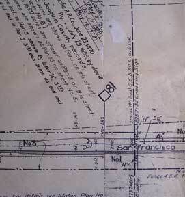
Switching Limits Map of Lathrop, San Joaquin County, Ca
Southern Pacific Lines (San Francisco, Calif.) · 1939 · Wittenborn Art Books
$300.00 (€272.18 | £227.08 | ¥47,891)
San Francisco, Calif.: Southern Pacific Company, 1939. Blueline print, from 24" x 55" to 30" x 55". Two maps cut and joined to detail switching limits, in red pencil. Includes station point Lathrop. With two incomplete Schedules of Purchase, approx 20 transfers, missing inform...