
Småtryk
Småtryk, postkort, plakater og trykte memorabilia.
Søgeresultater
45746 bøger i Småtryk

Right of Way and Track Map of Klamath Falls, Klamath County, or
Southern Pacific Lines (San Francisco, Calif.) · 1939 · Wittenborn Art Books
$350.00 (€317.55 | £264.92 | ¥55,873)
Sacramento, Calif.: Southern Pacific Company, 1939. Blueline print, 24" x 56". From California - Oregon State Line to Kirk. Includes Ewauna Park, Texum, Lot listings 1 1/2 miles south of Texum. Schedule of Property listing approx 15 transfers, 1906 - 1939. Scale 1" = 400'. .

Industry Map of Klamath Falls, Klamath County, or
Southern Pacific Lines (San Francisco, Calif.) · 1950 · Wittenborn Art Books
$375.00 (€340.23 | £283.84 | ¥59,864)
San Francisco, Calif.: Southern Pacific Company, 1950, rev. 1960. Blueline print, 25" x 64". With switching zones 1 - 5 indicated in colored pencils. From Texum, southern Yard Limits to Terminal City, Bisbee Street to Upper Klamath Lake. Includes Index to Industries with appro...

Industry Map of Klamath Falls, Klamath County, or
Southern Pacific Lines (San Francisco, Calif.) · 1950 · Wittenborn Art Books
$375.00 (€340.23 | £283.84 | ¥59,864)
San Francisco, Calif.: Southern Pacific Company, 1950. Blueline print, 24" x 55". From Texum, southern Yard Limits to Terminal City, Bisbee Street to Upper Klamath Lake. Includes Index to Industries with approx 85 entries, indexed by number on map and location by vertices. Wit...
Industry Map of Klamath Falls, Klamath County, Oregon
Southern Pacific Lines (San Francisco, Calif.) · 1950 · Wittenborn Art Books
$375.00 (€340.23 | £283.84 | ¥59,864)
San Francisco, Calif.: Southern Pacific Company, 1950, rev. 1952. Blueline print measuring 25" x 55". From Texum, southern Yard Limits to Terminal City, Bisbee Street to Upper Klamath Lake. Includes index to industries with approx 100 entries, indexed by number on map and loca...
Map of Hilt, Siskiyou County, Ca - Interchange Tracks with Fruit Growers Supply Company
Southern Pacific Lines (San Francisco, Calif.) · 1937 · Wittenborn Art Books
$350.00 (€317.55 | £264.92 | ¥55,873)
Sacramento, Calif.: Southern Pacific Company, 1937, Rev. 1938. Blueline print, 24" x 56". From 1000' south on railroad tracks from station point Hilt to 1000' west of Log Pond. Includes lumber shed, planing mill, warehouses, boom house, blacksmith and machine shop. Scale 1" = ...

Right of Way and Track Map of Ravenswood and Henderson, San Mateo County, Ca
Southern Pacific Lines (San Francisco, Calif.) · 1953 · Wittenborn Art Books
$350.00 (€317.55 | £264.92 | ¥55,873)
San Francisco, Calif.: Southern Pacific Company, 1953. Blueline print, 24" x 55". Five inch tear, no missing material. From Plumas Avenue and Terminal Avenue in Henderson to Alameda County Line. With San Francisco Bay Drawbridge, Ravenswood, San Francisco Bay, Rancho de Las Pu...
Plan of Henderson, San Mateo County, Ca
Southern Pacific Lines (San Francisco, Calif.) · 1929 · Wittenborn Art Books
$300.00 (€272.18 | £227.08 | ¥47,891)
Oakland, Calif.: Southern Pacific Company, 1929, rev. 1949. Blueline print. 8 x 52 inches. From Sevier Avenue to Del Norte Avenue along railroad tracks. Includes Newbridge Park, Henderson. Scale 1 inch = 100 feet. .
Right of Way and Track Map of Hayward, Alameda County, Ca
Southern Pacific Lines (San Francisco, Calif.) · 1945 · Wittenborn Art Books
$350.00 (€317.55 | £264.92 | ¥55,873)
San Francisco, Calif.: Southern Pacific Company, 1945. Blueline print, 24" x 56", with red pencil indicating switching limits. From Rancho San Leandro, Walnut Street to the northwest, to Rancho Arroyo de la Alameda, Meek Soto Tract, Meek Orchard, County Road 2688 to the southe...

Proposed Line Change Map of Hayden Junction, Pinal County, Az
Southern Pacific Lines (San Francisco, Calif.) · 1951 · Wittenborn Art Books
$350.00 (€317.55 | £264.92 | ¥55,873)
Tucson, Ariz.: Southern Pacific Company, 1951, rev. 1959. Blueline print, 24" x 56". Includes Hayden Junction employee' cottages, complex, with railroad track plans 1500' east and 3000' west of complex. With station points Hayden Junction, Burns. Scale 1" = 100'. .
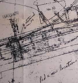
Proposed Line Change Map of Hayden, Pinal County, Az
Southern Pacific Lines (San Francisco, Calif.) · 1959 · Wittenborn Art Books
$375.00 (€340.23 | £283.84 | ¥59,864)
Tucson, Ariz.: Southern Pacific Company, 1959, rev. 1960. Blackline print, 24" x 83". Approx 2 mile stretch of present and proposed railroad tracks near Hayden Junction, Arizona. Map details track measurements and calculations. With Tailings Pond, hill. Scale 1" = 100'. .

Proposed Line Change Map of Hayden Junction, Pinal County, Az
Southern Pacific Lines (San Francisco, Calif.) · 1959 · Wittenborn Art Books
$200.00 (€181.46 | £151.38 | ¥31,927)
Tucson, Ariz.: Southern Pacific Company, 1959. Blackline print, 8" x 28". Approx 1 mile stretch of present and proposed railroad tracks near Hayden Junction, Arizona. No structures present, map details track measurements and calculations. Scale 1" = 200'. .
Station Plan of Glendale, Los Angeles County, Ca
Southern Pacific Lines (San Francisco, Calif.) · 1940 · Wittenborn Art Books
$500.00 (€453.64 | £378.46 | ¥79,818)
San Francisco, Calif.: Southern Pacific Company, 1940, rev. 1964. Blueline print, 24" x 78". From Goodwin Avenue, San Fernando Road to Glendale Boulevard, Brand Boulevard along Los Angeles street, Los Angeles city limits, railroad tracks. With Los Felix Boulevard, Gardena Aven...
Topographical Map of Giant, Contra Costa County, Ca - Possible Line Change
Southern Pacific Lines (San Francisco, Calif.) · 1964 · Wittenborn Art Books
$300.00 (€272.18 | £227.08 | ¥47,891)
San Francisco, Calif.: Southern Pacific Company, 1964. Blackline print, 24" x 38". Topographical map of area around Giant with present and proposed railroad tracks indicated. From Pablo Bay to Richmond Golf Course, extending approx 1 mile north and 1 1/2 miles east of Richmond...

Right of Way and Track Map, Sobrante, Contra Costa County, Ca
Southern Pacific Lines (San Francisco, Calif.) · 1932 · Wittenborn Art Books
$350.00 (€317.55 | £264.92 | ¥55,873)
San Francisco, Calif.: Southern Pacific Company, 1932. Blueline print, 24" x 55". From approx 1200' west of Sobrante Avenue juncture with railroad tracks to 1200' east of Sobrante station point. With Sobrante Park. Includes Schedule of Property listing approx 20 transfers, 187...
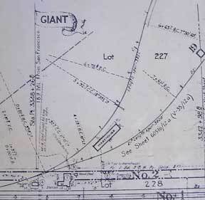
Right of Way and Track Map, Giant, Contra Costa County, Ca
Southern Pacific Lines (San Francisco, Calif.) · 1873 · Wittenborn Art Books
$350.00 (€317.55 | £264.92 | ¥55,873)
San Francisco, Calif.: Southern Pacific Company, [n.d.]. Blueline print, 24" x 55". From approx one mile south of station point Giant to station point Giant. No structures other than station and warehouse indicated, map primarily details track measurements and signals. Include...
Industrial Map of Fresno and Vicinity, Fresno County, Ca
Southern Pacific Lines (San Francisco, Calif.) · 1954 · Wittenborn Art Books
$700.00 (€635.09 | £529.84 | ¥111,745)
San Francisco, Calif.: Southern Pacific Company, 1954, rev. 1960. Blueline print, 27" x 108". Orange pencilling indicates switching zones. From Figarden, Biola Junction to station point Fowler, Walter Avenue and De Wolf Avenue. With station points Calwa, Calwa Tower, Goldleaf,...
Present and Proposed Pickup and Delivery Limits Map, Fresno, Fresno County, Ca
Southern Pacific Lines (San Francisco, Calif.) · 1953 · Wittenborn Art Books
$350.00 (€317.55 | £264.92 | ¥55,873)
San Francisco, Calif.: Southern Pacific Company, 1953. Blueline print, 18" x 15" with red and green highlighting indicating present and proposed limits. From Central Avenue to Teague Avenue, and Cornelia Avenue to Hammer Field. Not drawn to scale. .

Map of the City of Fresno and Vicinity, Fresno County, Ca
Southern Pacific Lines (San Francisco, Calif.) · 0 · Wittenborn Art Books
$300.00 (€272.18 | £227.08 | ¥47,891)
Fresno, Calif.: Chamber of Commerce, [n.d.]. Blueline print, 36" x 24", Marks Avenue to Willow Avenue and Annadale Avenue to Barstow Avenue. Red and yellow pencil shading highlight City Limits. With Central District map and street index, approx 400 listings, on back. Scale app...
Industrial Map of Fresno, Fresno County, Ca
Southern Pacific Lines (San Francisco, Calif.) · 1920 · Wittenborn Art Books
$350.00 (€317.55 | £264.92 | ¥55,873)
San Francisco, Calif.: Southern Pacific Company, 1920, rev. 1949. Blueline print, 24" x 56". From Belmost Avenue to Cedar Street, and E Street to Tulare Avenue. Includes PG&E Co, Grant Pacific Rock Co, Producers & Growers Market of Central California, West Compress Co, Sun Mai...

Fresno City Street Map, Fresno County, Ca
Southern Pacific Lines (San Francisco, Calif.) · 1942 · Wittenborn Art Books
$300.00 (€272.18 | £227.08 | ¥47,891)
Fresno, Calif.: Progressive Map Service, Southern Pacific notations approved 1942. Blueline print, 38" x 26", with red and blue pencil on map, attached typewritten and handwritten memorandum indicating proposed extension. Marks Avenue to Willow Avenue and Annadale Avenue to Ba...