
Småtryk
Småtryk, postkort, plakater og trykte memorabilia.
Søgeresultater
45746 bøger i Småtryk

Station Plan of Alviso, Santa Clara County, Ca
Southern Pacific Lines (San Francisco, Calif.) · 1953 · Wittenborn Art Books
$350.00 (€317.55 | £264.92 | ¥55,873)
San Francisco, Calif.: Southern Pacific Company, 1953, rev. 1959. Blueline print, 24" x 56". Sheet two of two. From Mountain View State Highway and railroad tracks to approx one mile south along Alviso Santa Clara County Road. Includes RT Collier Compnay, no other structures. ...

Station Plan of Alviso, Santa Clara County, Ca
Southern Pacific Lines (San Francisco, Calif.) · 1946 · Wittenborn Art Books
$350.00 (€317.55 | £264.92 | ¥55,873)
San Francisco, Calif.: Southern Pacific Company, 1946, rev. 1959. Blueline print, 24" x 57". Sheet one of two. From Slough to approx 0.5 mile south of county highway bridge over Guadalupe River, Gold Street to Hope Street. Includes Alviso station point, Bayside Canning, Sunset...
Station Plan of Alturas, Modoc County, Ca
Southern Pacific Lines (San Francisco, Calif.) · 1940 · Wittenborn Art Books
$350.00 (€317.55 | £264.92 | ¥55,873)
San Francisco, Calif.: Southern Pacific Company, 1940. Blackline print, 24" x 56". Sheet two of two. From Pit River to 1700' east of Alturas station. Includes Alturas station point, Willow Park Subdivision, State Highway, Mary C. Miller plot, PS Dorris plot, Churchill Street. ...
Station Plan of Alturas, Modoc County, Ca
Southern Pacific Lines (San Francisco, Calif.) · 1947 · Wittenborn Art Books
$350.00 (€317.55 | £264.92 | ¥55,873)
San Francisco, Calif.: Southern Pacific Company, 1947, rev. 1961. Blackline print, 24" x 56". Sheet 1B. From Modoc Street to Twelfth Street. Includes Alturas Box and Moulding, Consolidated Wholesale, Standard Oil, Wilson's Motel, Alturas Building Material, Superior Lumber, Pit...

Station Plan of Alturas, Modoc County, Ca
Southern Pacific Lines (San Francisco, Calif.) · 1957 · Wittenborn Art Books
$350.00 (€317.55 | £264.92 | ¥55,873)
San Francisco, Calif.: Southern Pacific Company, 1957, rev. 1962. Blackline print, 24" x 56". Sheet one of two. With railroad yard listed, including descriptions of buildings, no other structures present. Including railroad lines, private crossings, and US highway 395. Scale 1...
Station Plan of Albany, Linn County, Ore. - Toledo Branch
Southern Pacific Lines (San Francisco, Calif.) · 1958 · Wittenborn Art Books
$350.00 (€317.55 | £264.92 | ¥55,873)
Portland, Ore.: Southern Pacific Company, 1958, rev. 1961. Blackline print, 24" x 56". Sheet two of two. From Calapooia River to Main Street. Includes Monteith's, Southern Addition, Hackleman's First Addition, Willamette River, Albany Planing Mill, Ryal's Feed and Seed. Scale ...
Station Plan of Albany, Linn County, Ore. - Main Line
Southern Pacific Lines (San Francisco, Calif.) · 1958 · Wittenborn Art Books
$350.00 (€317.55 | £264.92 | ¥55,873)
Portland, Ore.: Southern Pacific Company, 1958, rev. 1961. Blackline print, 24" x 72". Sheet one of two. From Vine Street and Albany and Santiam Canal to Santiam Highway. Includes Vollstedts Feed Mills, Firestone, Buchauan Cellars, Central Junion High School, Railroad Yard, Ma...

Station Plan of Page/Albany, Linn County, Ore
Southern Pacific Lines (San Francisco, Calif.) · 1946 · Wittenborn Art Books
$350.00 (€317.55 | £264.92 | ¥55,873)
Portland, Ore.: Southern Pacific Company, 1946, rev. 1948. Blueline print, 24" x 56". Title is printed "Page," with "Albany" lightly printed over same position. From County Road 21/55 to 15th Street, and Ferry Street to US 99E/Pacific Highway. Includes John Millard's Land Plat...

Freight Tariff List, Ordered by Switching Limits
Southern Pacific Lines (San Francisco, Calif.) · 1961 · Wittenborn Art Books
$45.00 (€40.83 | £34.06 | ¥7,184)
San Francisco, Calif.: Southern Pacific Company, 1961. List of Freight Tariffs, 8.5" x 11", effective September 26, 1961. Lists item numbers and switching limits of Albany, OR; Alhambra, CA; Alturas, CA; Anaheim, CA; Anderson, CA; Antioch, CA; Armona, CA; Auburn, CA; Avon, CA;...
Plan of Alameda, Alameda County, Ca - Park to Blanding
Southern Pacific Lines (San Francisco, Calif.) · 1931 · Wittenborn Art Books
$375.00 (€340.23 | £283.84 | ¥59,864)
Oakland, Calif.: Southern Pacific Company, 1931, rev. 1962. Blueline print, 24" x 56". From beyond Oak Street to High Street, and border of Oakland Estuary to Lincoln Avenue. Includes downtown Alameda businesses, Lincoln Junction station point, Boyle Manufacturing Co, Pacific ...
Plan of Alameda, Alameda County, California - Waterfront, Webster Street to Sherman Street
Southern Pacific Lines (San Francisco, Calif.) · 1928 · Wittenborn Art Books
$375.00 (€340.23 | £283.84 | ¥59,864)
Oakland, Calif.: Southern Pacific Company, 1928, rev. 1961. Blueline print, 24" x 56". From Webster Street to Alaska Packers Basin warehouses, and Oakland Inner Harbor to Eagle Avenue. Includes University of California tract 32, John Huston plot, JD Box Factory. Scale: 1" = 10...

Station Plan of West Alameda, Alameda County, Ca
Southern Pacific Lines (San Francisco, Calif.) · 1949 · Wittenborn Art Books
$375.00 (€340.23 | £283.84 | ¥59,864)
Oakland, Calif.: Southern Pacific Company, 1949, rev. 1959. Blueline print, 24" x 56". Sheet two of two. From US Naval Air Station entrance to Main Street and Todd Shipyards Corporation. Includes US Naval Air Station with Officer's Quarters and Club, Oakland Estuary, Todd Ship...

Station Plan of West Alameda, Alameda County, Ca
Southern Pacific Lines (San Francisco, Calif.) · 1947 · Wittenborn Art Books
$375.00 (€340.23 | £283.84 | ¥59,864)
Oakland, Calif.: Southern Pacific Company, 1947, rev. 1960. Blueline print, 24" x 56". Sheet one of two. From Main Street to Webster Street, and Singleton Avenue to US Pierhead Line. Includes Air Force Intransit Depot, Federal Housing Authority, Todd Shipyards Company, Associa...
Station Plan of Alameda, Alameda County, California - Webster St.
Southern Pacific Lines (San Francisco, Calif.) · 1945 · Wittenborn Art Books
$350.00 (€317.55 | £264.92 | ¥55,873)
Oakland, Calif.: Southern Pacific Company, 1945, rev. 1961. Blueline print, 24" x 62". From Estuary and Pierhead line to Eagle Avenue, along Webster Street. Includes Air Force Intransit Depot, Federal Housing Authority, Bethlehem Shipbuilding Corporation, Associated Oil Compan...
Plan of Agnew, Santa Clara County, Ca
Southern Pacific Lines (San Francisco, Calif.) · 1958 · Wittenborn Art Books
$350.00 (€317.55 | £264.92 | ¥55,873)
San Francisco, Calif.: Southern Pacific Company, 1958, rev. 1961. Blueline print, 24" x 62". Sheet three of three. From approx half a mile north of Pittsburg Des Moines Steel to Keifer Road. Includes Pittsburg Des Moines Steel Co, railroad lines, power lines. Scale 1" = 100'. .

Plan of Agnew, Santa Clara County, Ca
Southern Pacific Lines (San Francisco, Calif.) · 1930 · Wittenborn Art Books
$375.00 (€340.23 | £283.84 | ¥59,864)
San Francisco, Calif.: Southern Pacific Company, 1930, rev. 1959. Blueline print, 24" x 56". Sheet two of three. From Bassett Street to Guadalupe Creek. Includes Commercial Solvents Corporation, Magnesia Plant, Western Carbonic Acid Gas Co, Lick Mill road, Agnew State Hospital...
Station Plan of Agnew, Santa Clara County, Ca
Southern Pacific Lines (San Francisco, Calif.) · 1957 · Wittenborn Art Books
$350.00 (€317.55 | £264.92 | ¥55,873)
San Francisco, Calif.: Southern Pacific Company, 1957, rev. 1961. Blueline print, 24" x 56". Sheet one of three. From Fifth Street North to beyond Montague Road along Alviso Santa Clara Road and railroad tracks. Includes Agnew State Hospital, corral, PG & E transformer yard. S...

Right of Way and Track Map of Westwood, Lassen County, California
Southern Pacific Lines (San Francisco, Calif.) · 1930 · Wittenborn Art Books
$350.00 (€317.55 | £264.92 | ¥55,873)
San Francisco, Calif.: Southern Pacific Company, 1930. Map. Blueline print. 24 x 56 inches. Includes station point Westwood, track markings, six blocks by two blocks of unmarked buildings between Cedar Street and Ash Street. With Schedule of Property listing 13 transfers, 1899...
Station Plan of West Glendale, Los Angeles County, California. Map
Southern Pacific Lines (San Francisco, Calif.) · 1942 · Wittenborn Art Books
$450.00 (€408.27 | £340.61 | ¥71,836)
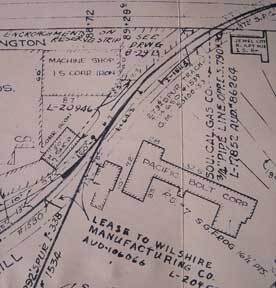
Los Angeles, Calif.: Southern Pacific Company, 1942, revised 1962. Map. Blueline print. 24 x 91 inches. Light scuffmarks. Along San Fernando Road, from Kellogg Avenue to Goodwin Avenue. Includes Los Angeles Channel, Ralph's Grocery Co, Cinch Products, Stires Drill, California ...

Switching Limit Map of Wellsdale, Benton County, to Cantonment, Polk County, Oregon
Southern Pacific Lines (San Francisco, Calif.) · 1945 · Wittenborn Art Books
$225.00 (€204.14 | £170.31 | ¥35,918)
San Francisco, Calif.: Southern Pacific Company, 1945. Notes added 1961. Map. Blueline print, 18" x 65" with red pencil indicating switching limits. Two maps joined together to indicate switching zones. From Wellsdale to Cantonment. Includes US Army Camp Adair. With Schedule o...