
Småtryk
Småtryk, postkort, plakater og trykte memorabilia.
Søgeresultater
45746 bøger i Småtryk

Map of City of Turlock, Stanislaus County, California
Southern Pacific Lines (San Francisco, Calif.) · 0 · Wittenborn Art Books
$200.00 (€181.46 | £151.38 | ¥31,927)
San Francisco, Calif.: Thomas Bros, [n.d.]. Map. Blackline print, 17" x 22", with some pencil additions. City limits, from West Avenue to Park Drive, and South Avenue to Syracuse Road. Scale 1" = 500'. .

Industrial Map of Turlock, Stanislaus County, California
Southern Pacific Lines (San Francisco, Calif.) · 1922 · Wittenborn Art Books
$300.00 (€272.18 | £227.08 | ¥47,891)
San Francisco, Calif.: Southern Pacific Company, 1922, revised 1931. Map. Blueprint, 24" x 36". From West Avenue to Oak Street, and D Street to beyond Standard Oil Co. Inclues Index to Industries with approx 60 listings. Scale 1" = 400'. .

Station Plan of Turlock, Stanislaus County, California. Map
Southern Pacific Lines (San Francisco, Calif.) · 1926 · Wittenborn Art Books
$350.00 (€317.55 | £264.92 | ¥55,873)
San Francisco, Calif.: Southern Pacific Company, 1926, revised 1940. Map. Blueprint, 24" x 55". From State Highway and State Highway crossing to Orchard Street, Geer Avenue. Includes Smithland Farm tract, Carl Peterson tract, Levard Park. Scale 1" = 100'. .

Industry Map of Tucson, Arizona and Vicinity
Southern Pacific Lines (San Francisco, Calif.) · 1954 · Wittenborn Art Books
$350.00 (€317.55 | £264.92 | ¥55,873)
San Francisco, Calif.: Southern Pacific Company, 1954. Map. Blueline print, 22" x 77". From Casa Grande Road to Davis - Monthan Air Force Base. Includes city of Tucson, station points Petrie, Tucson, P.F.E. Yard, Wilmot. Scale 1" = 1000'. .

Right of Way and Track Map of Tempe, Maricopa County, Arizona
Southern Pacific Lines (San Francisco, Calif.) · 1957 · Wittenborn Art Books
$350.00 (€317.55 | £264.92 | ¥55,873)
San Francisco, Calif.: Southern Pacific Company, 1957. Map. Blueline print, 24" x 55". Includes Normal Junction, Tempe Junction. Map is primarily railroad track with measurement markings, with some numbered buildings at Tempe Junction. Includes Schedule of Property with 10 tra...

Right of Way and Track Map of Tempe, Maricopa County, Arizona
Southern Pacific Lines (San Francisco, Calif.) · 1936 · Wittenborn Art Books
$350.00 (€317.55 | £264.92 | ¥55,873)
San Francisco, Calif.: Southern Pacific Company, 1936. Map. Blueline print, 24" x 55". Includes Normal Junction, Alma School. Map is primarily railroad track with measurement markings. Includes Schedule of Property with 30 transfers, 1903-1936. Scale 1" = 400'. .

Right of Way and Track Map of Tempe, Maricopa County, Arizona
Southern Pacific Lines (San Francisco, Calif.) · 1875 · Wittenborn Art Books
$350.00 (€317.55 | £264.92 | ¥55,873)
San Francisco, Calif.: Southern Pacific Company, [n.d.]. Map. Blueline print, 24" x 55". Includes Salt River, station points Tempe and Tempe Junction. Includes Schedule of Property with 3 transfers, 1875-1887. Scale 1" = 400'. .

Station Plan of Tempe, Maricopa County, Arizona. Map
Southern Pacific Lines (San Francisco, Calif.) · 1931 · Wittenborn Art Books
$350.00 (€317.55 | £264.92 | ¥55,873)
San Francisco, Calif.: Southern Pacific Company, 1931. Map. Blueline print, 24" x 55". Includes Salt River, station points Tempe and Tempe Junction. Includes Schedule of Property with approx 20 transfers, 1875-1931. Scale 1" = 400'. .

Station Plan of Swanston, Sacramento, California. Map
Southern Pacific Lines (San Francisco, Calif.) · 1923 · Wittenborn Art Books
$350.00 (€317.55 | £264.92 | ¥55,873)
Sacramento, Calif.: Southern Pacific Company, 1923. Map. Blueprint, 24" x 55". Including Essex Lumber Co. Essex Lumber turn off, Stock Corral. Scale 1" = 100'. .

Set of Two Maps of Susanville, Lassen County, California
Southern Pacific Lines (San Francisco, Calif.) · 1933 · Wittenborn Art Books
$350.00 (€317.55 | £264.92 | ¥55,873)
Ogden, Utah: Southern Pacific Company, 1933. revised 1954. Map. Two blueline prints, 24" x 55". Joined with pin and handwritten memo. One map primarily features Lassen Lumber and Box Co, other map details Susanville from Mill Pond to West St. Scale 1" = 100'. .
Map of Susanville, Lassen County, California
Southern Pacific Lines (San Francisco, Calif.) · 1933 · Wittenborn Art Books
$175.00 (€158.77 | £132.46 | ¥27,936)
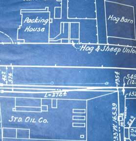
Ogden, Utah: Southern Pacific Company, 1933. revised 1936. Map. Blueprint, 8" x 39". Includes Susan River, Standard Oil Co, and Cattle, Hog and Sheep Yards. No buildings other than Standard Oil and animal yards. Scale 1" = 100'. .

Map of Susanville, Lassen County, California
Southern Pacific Lines (San Francisco, Calif.) · 1929 · Wittenborn Art Books
$350.00 (€317.55 | £264.92 | ¥55,873)
Ogden, Utah: Southern Pacific Company, 1929. Map. Blueprint, 24" x 55" From Tulare Street to Richmond Road and Lassen Street. Includes legend of buildings in Lassen Lumber and Box Company, and Fruit Growers' Supply Company. With extensive overlapping land use notes. Scale 1" =...
Map of Stockton, Fresno County, California
Southern Pacific Lines (San Francisco, Calif.) · 1961 · Wittenborn Art Books
$225.00 (€204.14 | £170.31 | ¥35,918)
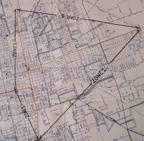
San Francisco, Calif.: Thomas Bros Maps, addition of switching zones approved 1961. Map. Blueline print, 24" x 19" with orange, green, red, and brown pencilling indicating switching zones. From French Camp to Eight Mile, and Bucley Cove to Windsor. With index to streets and po...

Station Plan of Stockton, Fresno County, California
Southern Pacific Lines (San Francisco, Calif.) · 1926 · Wittenborn Art Books
$350.00 (€317.55 | £264.92 | ¥55,873)
San Francisco, Calif.: Southern Pacific Company, 1926. Map. Blueline print, 24" x 55" with red and black pencil. From Little John Creek and French Camp Slough to beyond French Camp crossing. Includes Sperry Flour, Western Lumber Sales Co, Mosswood Park. Scale approx. 1" = 100'. .

Industry Map of Stockton and Vicinity, Fresno County, California
Southern Pacific Lines (San Francisco, Calif.) · 1926 · Wittenborn Art Books
$350.00 (€317.55 | £264.92 | ¥55,873)
San Francisco, Calif.: Southern Pacific Company, 1926, revised 1930. Map. Blueline print, 23" x 36", with extensive multicolor pencilling indicating zones, and yard limits. Two 12" tears and two smaller, no missing material. "See Revised Map" written in large letters across si...

Industry Map of Stockton and Vicinity, Fresno County, California
Southern Pacific Lines (San Francisco, Calif.) · 1926 · Wittenborn Art Books
$350.00 (€317.55 | £264.92 | ¥55,873)
San Francisco, Calif.: Southern Pacific Company, 1926. Map. Blueline print, 23" x 36", with extensive multicolor pencilling indicating zones, and yard limits. Two tears ears along entire length joined together with no longer adhering tape, no missing material. From French Camp...

Industry Map of Stockton and Vicinity, Fresno County, California
Southern Pacific Lines (San Francisco, Calif.) · 1950 · Wittenborn Art Books
$425.00 (€385.59 | £321.69 | ¥67,845)
San Francisco, Calif.: Southern Pacific Company, 1950, revised 1959. Map. Blueline print, 28" x 49", with extensive brown, red, blue, orange and green pencilling indicating zones, and yard limits. From French Camp to Calaveras River, and San Joaquin River to US 99/Manteca Road...

Yard Limits Map of Stockton, Fresno County, California
Southern Pacific Lines (San Francisco, Calif.) · 1935 · Wittenborn Art Books
$375.00 (€340.23 | £283.84 | ¥59,864)
Oakland, Calif.: Southern Pacific Company, 1935. Map. Blueline print, 21" x 71". From State Highway and McKinley Avenue to Harding Way. Includes Mormon Slough, Stockton State Hospital, 10 blocks by 27 blocks of downtown along railroad tracks. Scale 1" = 400'. .

Industry Map of Stockton and Vicinity, Fresno County, California
Southern Pacific Lines (San Francisco, Calif.) · 1950 · Wittenborn Art Books
$400.00 (€362.91 | £302.77 | ¥63,855)
San Francisco, Calif.: Southern Pacific Company, 1950. Map. Blueline print, 42" x 73", with extensive red, purple, orange and green pencilling indicating structures, zones, yard limits, track lines, and crossings. From French Camp to Calaveras River, and San Joaquin River to U...

Map of Stockton Port District and Vicinity Developement, Fresno County, California
Southern Pacific Lines (San Francisco, Calif.) · 1945 · Wittenborn Art Books
$225.00 (€204.14 | £170.31 | ¥35,918)
San Francisco, Calif.: Southern Pacific Company, 1945. Map. Blueprint, 12" x 39". Faded but legible. From Burns Cut Off to Mormon Channel. Includes Stockton Deep Water Channel, Country Club, Turning Basin. Scale 1" = 800'. .